EX03 — Regional Coverage
Tags: coverage · polygon region · area weighting
Input: regional-coverage.yaml · Runtime tier: standard · Recommended views: 2D, Analysis
Purpose
Measure how often a 24-satellite constellation covers Europe and show why an equal-point average and a represented-surface-area average answer slightly different questions.
Setup
The six-hour study uses a 2.5° regional grid, a 20° minimum elevation mask, and a 24-satellite Walker constellation at 600 km.
astraeus run astraeus-resources/examples/user/regional-coverage.yaml
RunSpec Focus
coverage_scope: roi_only bounds calculation and artifacts to the selected
region. Raw per-sample coverage is disabled because the summary artifacts are
enough for this comparison.
geography:
  coverage_scope: roi_only
  selection: europe
  grid_step_deg: 2.5
  min_elevation_deg: 20.0
artifacts:
  write_coverage_raw_samples: false
Results
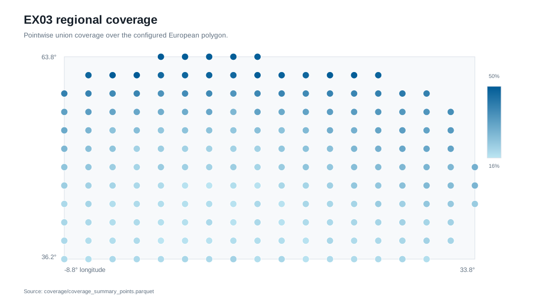
The reference run completed successfully in 0.53 seconds and evaluated 189 represented cells across 181 timestamps. Mean union coverage was 26.45% using equal point weighting and 25.04% using represented spherical surface area.
Artifacts To Inspect
| Artifact | What it shows |
|---|---|
coverage/coverage_summary.json |
Global aggregation, grid metadata, weighting method, and artifact shapes |
coverage/coverage_summary_by_area.parquet |
Equal-point and represented-area results for each selected region |
coverage/coverage_summary_points.parquet |
Coverage, pass counts, gaps, and visible-satellite counts for every cell |
coverage/coverage_points.parquet |
Coordinates and represented surface weights used by the aggregation |
Interpretation
The 1.40 percentage-point difference is expected: equal-angle grid cells cover less physical surface toward higher latitudes. Use point weighting when every sample point is intentionally equal; use area weighting when the result should represent geographic surface. The geometry guide defines both aggregations.